
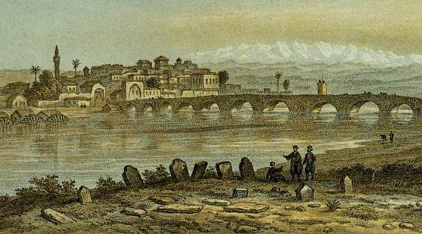
“We were at Adana 2 nights and Theodore was very busy with the arrangements for our journey into the Interior, for, like Africa, Asia Minor has an Interior.” (Mabel Bent’s Chronicle, early March 1890)
For the background to the discovery of this ‘lost’ Bent manuscript from the archive of the Royal Geographical Society, London, see below. Annotated and illustrated here, it is transcribed in full, presumably for the first time, and will be of particular interest to specialists in all fields of Anatolian studies as well as modern travellers to this still scarcely referenced region north of Adana. Some sections have appeared in other pieces by Bent, but never this complete text. We are extremely grateful to the Royal Geographical Society (RGS-IBG) for kindly allowing the first transcription and publication of this article. The transcription is by the Bent Archive.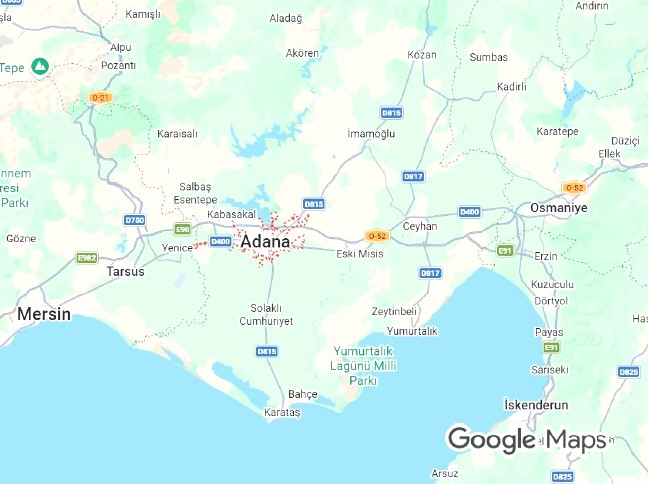
From Mabel Bent’s diary, these are the approximate travel dates for the sites in today’s south-eastern Türkiye referenced in Bent’s article, e.g., after 26 February 1890 the Bents leave Mersin, halting at Tarsus and Adana, for Sis (Kozan), reaching there on 6 March; 10 March the party rides south to Anazarba (Anavarza); 13 March to ‘Kars Bazaar’ (Kadirli); 15 March, via Hemita Kaleh (Hemite Kalesi) to Hieropolis-Castabala (‘Bodroum/Boudroum’). The couple spend four days at the latter site, leaving on 19 March and reaching Mersin again on 22 March 1890. They then revisit the Lamas Valley region (having surveyed it briefly before making for Sis) and achieve the identification of the remains of Olba… called by one scholar ‘Bent’s Pompeii’.
Bent’s unpublished RGS PAPER/article 1890
[Cite as: J. Theodore Bent, ‘Exploration in the North East of the Cilician Plain’. From a MS in the archive of the Royal Geographical Society, London (1890); transcription: Bent Archive 2026.]J. Theodore Bent, ‘Exploration in the North East of the Cilician Plain’
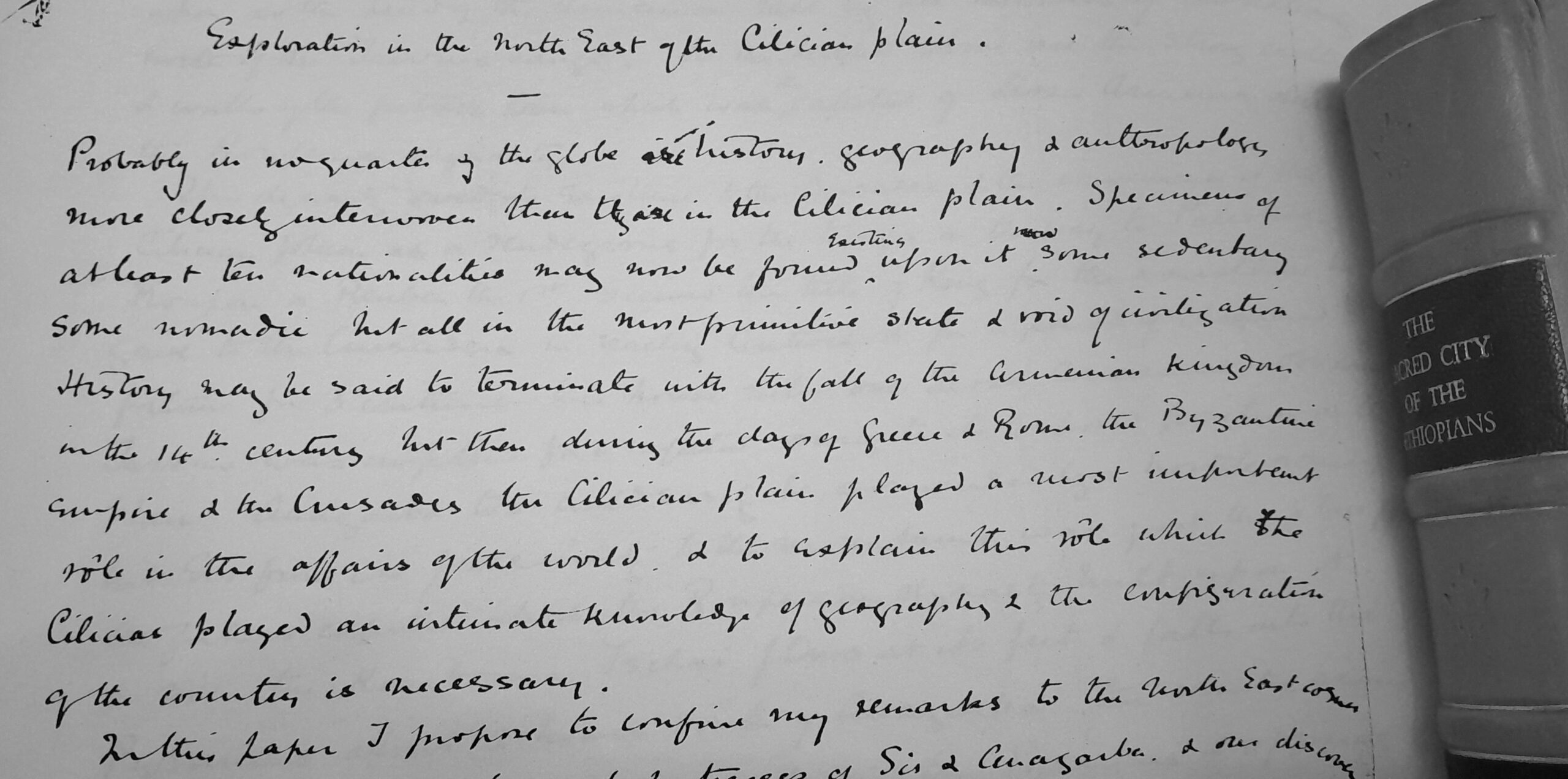
Probably in no quarter of the globe are history, geography and anthropology more closely interwoven than they are in the Cilician plain. Specimens of at least ten nationalities may now be found existing upon it, some sedentary, some nomadic, but all in the most primitive state and void of civilization. History may be said to terminate with the fall of the Armenian Kingdom in the 14th century, but then, during the days of Greece and Rome, the Byzantine Empire and the Crusades, the Cilician plain played a most important rôle in the affairs of the world, and to explain this rôle which the Cilicias played, an intimate knowledge of geography and the configuration of the country is necessary.
In this paper I propose to confine my remarks to the North East corner, describing our visit to the rock fortresses of Sis and Anazarba and our discovery of an ancient site on the Pyramus called Hieropolis-Castabala, which played an important part in the itinerary of Alexander the Great, with a description of the present condition of the country and the nomadic tribes amongst whom we lived during our stay there.
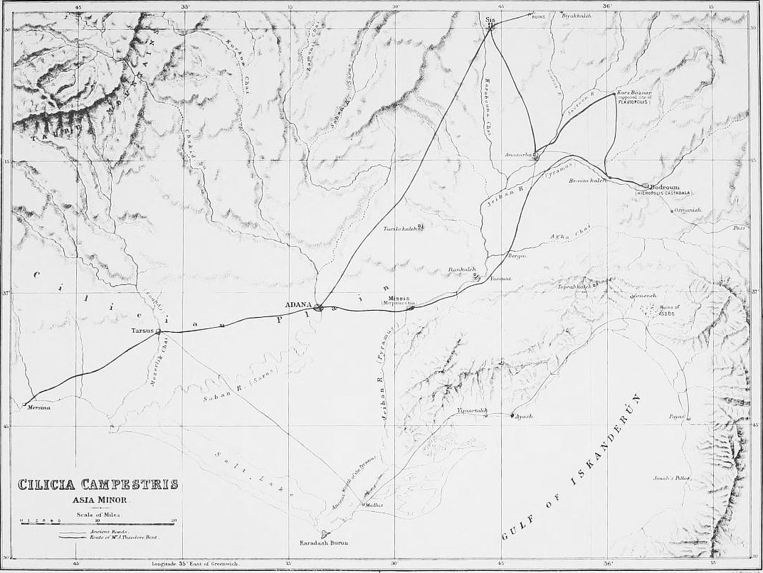
After crossing a series of low hills behind Adana of conglomerate covered with clay which divide the southern part of the plain from that portion which stretches into the heart of the Taurus Mountains, a long expanse of wild, desolate country is entered without any signs of cultivation and entirely given up to the nomad tribes who here pasture their flocks during the winter months. Certain rocks appear in the vast extent of plain crowned with old fortress cities of the Armenian Kingdom, rising like islands out of the flat expanse. Ylan Kaleh, or the serpent castle, Tumlo Kaleh, and the fortresses of Anazarba and Sis, with which we have now more especially to deal.
Sis is situated at the edge of the plain and is divided from the mountain ranges only by a narrow valley. It is a mean town now, consisting of about 200 houses inhabited by Armenians and the convent on the hillside where the patriarch or Catholicos resides, who carries on the faint tradition of upholding the Armenian Kingdom and who is in open rivalry with the Catholicos of Etchmiazen in northern Armenia, who is looked upon as the head of the Armenian race by all members of the nationality north of the Taurus range. note 1 On the height above are the strong castle and walls of the fortress town which was the capital of Lesser Armenia during the Roupenian dynasty.
This dynasty owed its existence to the Crusades and the conveniences of the Cilician plain as a rendezvous for the troops on the way to Palestine. Roupan or Reuben the 1st received the title of king for the assistance he gave to the Crusaders in reaching Antioch, and for a period of chequered fortune for three centuries this house ruled over Lesser Armenia. Obviously, Tarsus was unfitted for a capital owing to its exposed position on the plain. Anazarba, too, could easily be surrounded by a hostile army, but Sis, from its proximity to the mountains, was just the place for the fortress capital which the Roupenian dynasty built upon it. A river, the Karabouna Tschai, flows at its feet and falls into the Pyramus about two hours south of Anazarba. The country around is a network of streams all feeding the Pyramus and offering great difficulties to the traveller, especially in spring after the melting of the snows, as there are but few bridges and the fords become dangerous. In the mountains behind Sis are numerous fortresses which the Armenians could retire to when pressed by an enemy; one of these, Kirk Capon, or 40 Gates, which we visited, has the ruins of an old basilica and several heroa and tombs dating from the Roman period but Sis itself shows no earlier ruins than those of the Armenian period. note 2
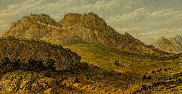
The castle of Sis is very difficult of access and the walls are preserved intact; the circle enclosed by them is oval in form. There are three gates and the space within is divided into three distinct parts by the shape of the mountains and is a mass of ruins. From an Armenian inscription we learn that Leo II in 1186 greatly increased and strengthened it. For fully a mile these ruins crown this elevated ridge looking down on the vast plain; these are ruins of forts, churches, subterranean vaults, and domestic buildings. The highest point is 1200 ft above the sea level and this area within the walls is a favourite pasturage for the nomads, for there is a pond at the top fed by a never-failing spring which is delightfully cool in summer. The views over the snow-capped peaks of the Taurus on the one hand, and the expanse of the plain on the other, with its network of streams, is exceedingly striking. Just below the fortress is what is left of the palace of the takovars or princes of the Roupenian dynasty when they held their court after removing from Tarsus, but this palace has been pulled to pieces to build the convent on the slope close by. Wilbrand, a canon of Oldenburg in Germany, who wrote an account of his travels in 1211, describes the gardens of King Leo II on this slope as passing description for beauty. note 3
The importance of the Cilician plain is illustrated by the intercourse between the Roupenians and western Europe. Three orders of chivalry, the Hospitallers, the Templars, and the Knights of the Teutonic order, were allotted forts and cities in the districts by the Armenian kings in recognition for their services in keeping the Seljukians of Iconium on the other side of the Taurus, and then the three Italian Republics had each of them golden hills from the kings which gave them a strong foothold in the district. Leo II gave Genoa her charter in 1215, by which she was accorded a street in Tarsus, land for a church, baths, and an oven and a garden. With the fall of the Crusades and the extinction of the religious mania they inspired the Roupenian dynasty to fall and Leo VI abandoned all his fortresses to the Turks and died in Paris in 1393.
There is a long stretch of plain to be crossed between Sis and Anazarba and the river Sombaz, another tributary of the Pyramus. The ground is exceedingly marshy and covered with tall reeds, perfectly uninhabitable in summer from its malarious exhalations. The unhealthiness of the Cilician plain is historical. Alexander the Great nearly fell a victim to it in Tarsus, and a Knight Templar writing to the Pope (Arch. Imp. de France) says: “This land is itself to sickly and bad that if 4000 horseman passed through it, however strong and well, it would be wonderful if at the end of the year 500 would be found”. note 4
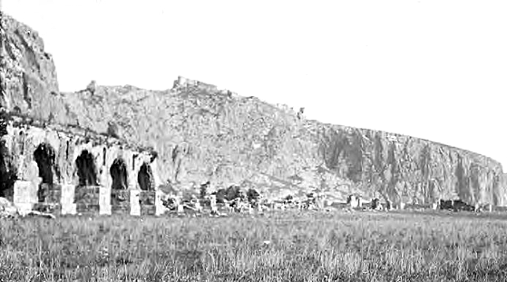
The features of this portion of the plain are the remains of the two gigantic aqueducts which supplied Anazarba with water when it was the great city of the district during the Empire, Cæsarea penes Anazarbum as Ptolemy calls it. note 5 It was very flourishing under the imperial favour and it was granted the rights of a metropolis. There is another underground aqueduct also, so the town was amply supplied with water. One of the aqueducts brings water from the source of the Sombaz where there are fine springs at the edge of the mountains.
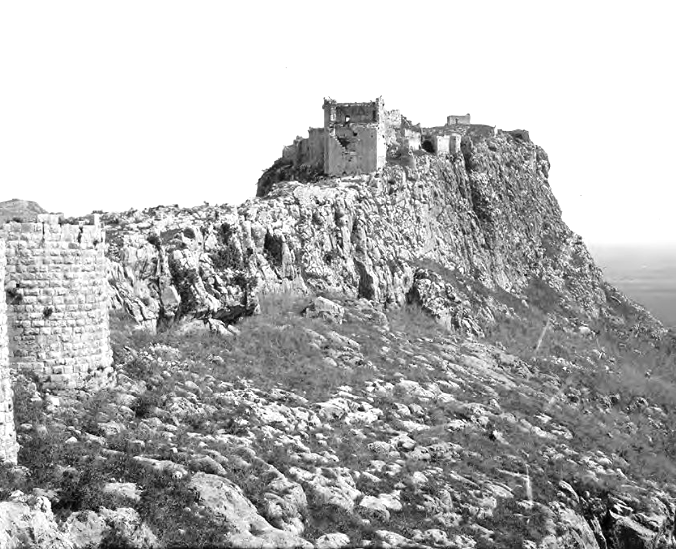
The appearance of Anazarba is most striking. The fortress crowns a high ridge about four miles long, reaching an elevation of 1000 feet, rocky, barren, and for the greater part of its extent inaccessible, arising in solitary grandeur out of the vast plain; being as it is ten miles from the mountains, its appearance of isolation is more marked than Sis and as a stronghold its importance must have been great. A few miles to the South East flows the Pyramus, the Sombaz and Savroun rivers unite just below, flowing on either side of it, therefore it is protected not only by its natural strength but by the two streams on either side of it. Wilbrand in his travels thus describes it: “A strong castle eight miles from Sis on a high mountain in the middle of the plain”. note 6 Leo II gave some fêtes here at which this canon of Oldenburg was present. The walls of the ancient town commence at the foot of the mountain and enclose a space of about one square mile; those which are now standing are of Saracen workmanship, but blocks of Roman masonry and inscriptions of the time of the Emperors are inserted into it. The sheer walls of the mountains are covered with rock cut tombs, sarcophagi and bas reliefs, none of them of a Pre-Roman period but all pointing to the importance of the place during the Empire.
The fortress which crowns the hill is entirely of Armenian structure and is still in excellent preservation, far superior to the ruins of Sis. In the centre of a large open space is a small chapel with a long Armenian inscription round it stating that it was built by Theodore or Thoros, the third king of the Roupenian dynasty. One side of this mountain is admirably protected by nature, offering a continuous line of precipitous cliffs 800 feet in height. Anazarba suffered severely from an earthquake in the reign of Justinian. He rebuilt it and the arch of triumph, which is still fairly preserved, was erected on the occasion. There is a curious rift in the mountain forming a gully or pass over to the other side, which was evidently, from inscriptions cut on the rock, used as a place of refuge in times of distress.
During our stay at Anazarba we put up in the wicker huts of a nomad tribe of Afshars who live within the ancient walls during the winter months; this gave us ample opportunity of studying their customs. When in the north of Persia, we passed a considerable time amongst this numerous tribe who inhabit the mountains anciently comprising the old kingdom of Media. note 7 Their origin and history would appear to be lost in obscurity. All that is known of them is that in 1508 this tribe, in conjunction with six others, succeeded in assisting Shah Ismael in his wars and obtained from him considerable privileges until their power became too great and Shah Abbas incorporated the Shah Sevan tribe (or friends of the Shah) to counteract their influence. The Afshars in Persia are practically independent under khans who dwell in their mountain fortresses and defy government interference. The nomads who penetrate into the Cilician plain are under the control of their aghas, who are responsible for their good conduct to the government.
Until recent years an Afshar chief called Khozan Agha ruled supreme in the district of Sis, holding the mountain passes and keeping the inhabitants in a perpetual state of terror; he was conquered after a long struggle extending over many years by the governors of Adana and the county is now comparatively safe to traverse, though certain Circassian tribes are ever on the look out to perpetuate small acts of brigandage if they can do so with impunity. In Persia the Afshars would appear to be of Kourdish origin from their names and propensities, while the Afshars to the south are much mixed up with Armenians, having old Armenian words in their dialect of Turkish and names of a distinct Armenian provenance. In Persia they talk Tatar Turkish but to the south their dialect is little different from that of the other nomads amongst whom they live. The Afshars with whom we dwelt during our stay at Anazarba were encamped just inside the ruined walls and had built themselves huts out of the reeds which crown the neighbouring marshes. Most of these miserable tenements were in a most dilapidated condition from the fact that the spring was near. When they go up to the mountains they set fire to their huts and then rebuild them the following winter, consequently they do not care to keep them in order. Most of them consist of two rooms with a partition in the middle; the floors are of mud and very moist in wet weather, which it unfortunately was during most of our stay at Anazarba, so that we had to sleep under waterproofs and umbrellas.
Large dogs, as large if not larger than St Bernards, are their only protection and are very savage. At night time they are trained to prowl around and give warning of the approach of any enemy. They cut the ears so that they may hear better. “Better shoot one of the children than one of their dogs” I was warned when threatening to shoot one if attacked.
The nights we spent in these huts were miserable and it would seem that the Afshars never sleep and all night long they are watching their cattle, driving them from their reed huts, which they were constantly trying to eat and no peace of any sort could be got. At early dawn the noise of the churning began and quiet only appeared to reign during the absence of the flocks at their pasturage.
The Afshar is quite a different individual to the Yourouk, or nomad, of the neighbouring mountains to the West. He is not so well built; he is swarthy, has a round and often hairless face and small, narrow eyes; a face which often reminds us of the Chinese type, and it would seem that he hails from very far away in the heart of Asia. At the neighbouring encampment of Hemita Kaleh the resemblance to the Chinese was even more strongly marked than at Anazarba. An Afshar without his fez, with the front part of his hair shaved close and left to grow long behind, with his yellow skin, high cheek bones and almond-shaped eyes, would pass very well for an inhabitant of the Celestial Empire. Many of the Afshars aspire to a great age. We were shown one who said he was 121 and could walk well, going up every summer to the yaelas, or mountain pasture, the only point, however, that seems certain is that this nomadic life is conducive to great old age and that longevity is common amongst them.
The women are fat and stumpy; some of them decidedly handsome. Down their backs they wear long plaits of hair to which they attach still longer additions made of cotton or silk and dyed to suit the colour of their hair, so at first sight it could appear that their plaits of hair hang down almost to their heels. note 8 On these false plaits they fasten odds and ends of silver ornaments and they call them ourmeh. Their faces are always unveiled, except a bride, who conceals her face for the space of a year and she is condemned to silence, like the custom is amongst the Armenians, until her first child is born. Most of the women have their noses bored and into the hole they put a clove, which puzzled us for a long time for it resembled a nail, the idea being, I imagine, to sweeten the breath.
They wear embroidered jackets and red drawers which come below their knees and they go about with bare legs and feet. Modesty seems to be a thing unknown amongst them, several times we saw women stark naked by a stream washing themselves and their clothes, and the presence of men in their vicinity did not appear to disconcert them in the least.
For fuel they use nothing but the reeds from the neighbouring marsh, which they put damp on to their fires and they go off like musketry, rather alarming at first in the darkness, for we never felt sure that we might not be disturbed by a band of Circassian robbers. In an adjoining encampment where reeds were not so plentiful they make tezek or dung cakes for fuel; the refuse of the stable is spread out in the sun, mixed with straw and water, and with naked feet the women, who are chiefly employed in the industry, may be seen trotting almost all day in this delightful composition until it has assumed the required consistency. It is then left to dry a little, when round cakes are made, or square blocks, and then it is stacked. New tezek is very objectionable to, from being decidedly odoriferous, but old tezek is not unlike peat.
The men of some of these tribes wear very pretty, loose blue jackets embroidered with gold and carry narrow-handled guns, beautifully chased and with the barrel decorated with six or seven bands of silver.
There are also some Bosdans or followers of Bosadan Oglou in the neighbourhood of Anazarba. This tribe would seem to be closely allied to the Afshars and come, I imagine, from the same stock. They are very like them in personal appearance. Their women wear the same costume, only that they have large gold circular ornaments at each ear and are altogether more lavish in the number of silver and other ornaments, which they contrive to fasten on to the ourmeh or false plait which hangs down their back.
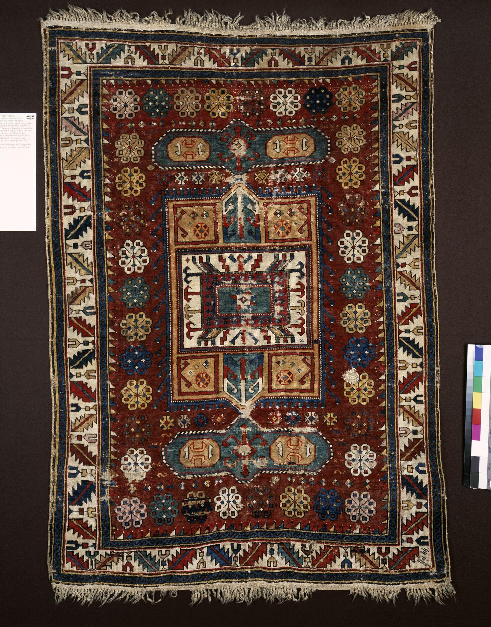
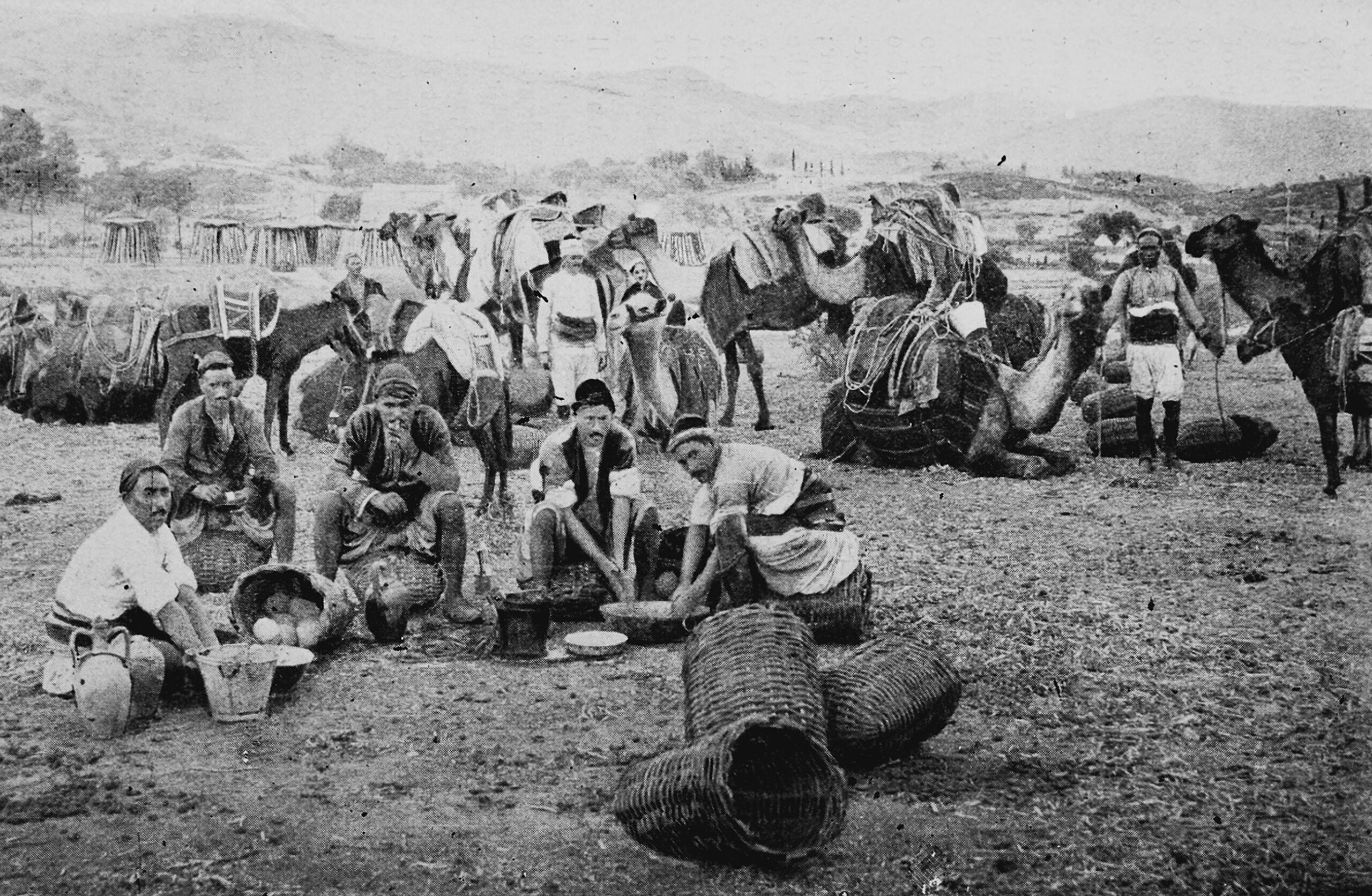
The women of these tribes are great workers and besides their milking and churning they contrive to turn out a great number of their gelims or course carpets, inferior indeed to the Karamanian carpets made by the Yourouks, but very effective when the patterns are elaborate and the colours well blended. In every wicker house is the loom and the hole in the ground where the legs of the women disappear to work the pedals of her instrument. By the Zeihan, the ancient Pyramus, which flows a few miles to the South-East of Anazarba, the tribe have great quantities of buffalos and rude carts with large round wheels made out of one piece of wood with the axle passed through. At Bodroum, where we again lived amongst Afshars for some days on the banks of the Pyramus. We found the houses a little more comfortable, being built out of wattle and bamboo and covered on the inside with pats of manure, which they whitewash and decorate with rude patterns in henna. Here the women wear a different costume, red leather shoes to keep off the snakes, red baggy trousers, blue skirt and red satin jacket, a fez bound round with lace, and splendid gold ornaments at each ear, and a frontlet of coins. Altogether, the Afshars of Bodroum appear vastly superior to those who live at Anazarba and are more stationary, only going to the neighbouring mountains for their summer pasture and not burning their houses when they go away, whilst those of Anazarba have their summer haunts far away in the interior, not far from Kaisariyeh.
The Afshars and tribes kindred to them are comparatively a peaceful race now, but the Circassians are the great robbers and dread of the neighbourhood, stealing cattle, women, and anything they can lay their hands on. They are great dealers in horse and breeders too, and ride fiery young steeds which soon distance them from any pursuit. All the marshy ground by the banks of the Pyramus is a perfect nursery for young horses and is covered with them for miles. The head bey of a neighbouring village, a settlement of Circassians, who came to pay us a visit whilst we were at Anazarba, had, I was told, 2000 horses for sale; this amount was, I have no doubt, greatly exaggerated but we saw for ourselves as we rode along the Pyramus a vast number of mares and colts.
The Circassian wedding is an interesting spectacle to witness. They are strictly exogamists and never marry amongst their own people, purchasing wives from another tribe of Circassians. The betrothal, consequently, and the arrangement of the sum to be paid by the husband is an affair of almost more importance than the wedding; it is, in fact, a sale conducted not in money but in mares or baitals as the standard of value. One camel = 5 mares and one mare = 20 sheep, and so on. As a sign that the contract is concluded a sheep is roasted whole and various other dishes prepared and the young Circassian girls play all sorts of practical jokes on the visitors before their departure. The wedding is comparatively a mild affair, the betrothal being the great matrimonial festivity amongst them.
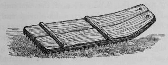
As to cultivation, there is very little of it to be seen in the North-East corner of the Cilician plain. Near Bodroum was saw some fields of wheat and the tools were primitive. The Roman bipalium with the crossbar, which is useful in helping them to drive it further into the ground, is still used by them as a spade, and the threshing board with flint stuck all over it below cannot be very different from the “new sharp threshing instrument having teeth” of Isaiah XLI. 15, note 10 and their sheep are all of the broad-tailed tribe common to the East, tails which the sheep have immense difficulty in carrying and though I never actually saw one, I quite believe the story that the shepherds sometimes make little wooden carts to assist the sheep in carrying its heavy appendage. I always looked on this as a traveller’s story till I saw the tails on the Cilician plain and heard that they often provide this convenience for their flocks. In Lev. 111. 9 the directions laid down by Moses must have referred to sheep of this description, and Herodotus Bk III, Ch. 13, where he speaks of sheep with tails “one cubit in width” was not far wrong in his calculation. Moreover, we see them depicted for us on the bas reliefs of Persepolis and doubtless the sheep of the nomads are descendants of these. The fat is very useful in cooking and is an excellent substitute in these wild parts for lard, far preferable to the rancid butter with which we were generally provided for cooking purposes.
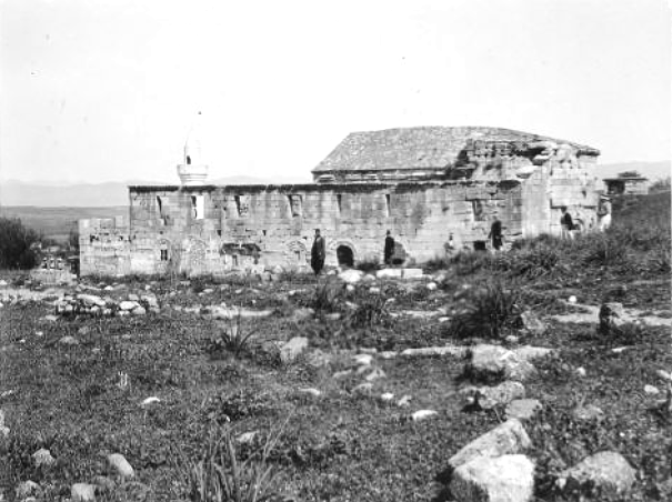
On leaving Anazarba we rode for several hours Eastward across the plain, crossing the Sombaz by a bridge and the Savroun by a ford and reached Kars Bazaar, a place full of ruins on a gentle eminence above the river at the foot of the mountains. note 11 In a cottage we found a lovely tessellated pavement with an inscription stating that it had been put down by the fullers’ guild. In early Christian times this must have been a spot of note, a monastic building, now a mosque, being of 500 A.D., but we found no inscriptions to guide us to its name, but two points lead me to believe it was Flaviopolis, firstly, from coins we learn that it was on a river, and secondly it was the first station on the road eastwards after Anazarba.
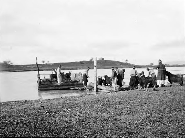
Hearing of extensive remains at a spot called Bodroum about 5 hours distant from Kars Bazaar, the name of which had not been identified, we determined on visiting them and devoting some time to the thorough exploration of the district. About four hours to the South-East of Kars we reached the banks of the Zeihan, the Pyramus of antiquity, a rapid, muddy stream which is continually altering its course and washing away the sandy banks on either side so that a ferry which connects the main road has to be moved from place to place as the necessity requires. The mountains come right down to the stream at a spot called Hemita Kaleh. note 12 On a rock is situated a medieval castle, which must have entirely commanded the right bank. Bodroum is almost three miles from this spot further up the stream and shortly after the Zeihan has emerged from the defile through which it makes its way to the Cilician plain from its sources in the Taurus range. The ruins are situated almost three-quarters of a mile from the river and cover an enormous extent of ground. The ancient acropolis crowned a rock at the extreme edge of a narrow spur of mountains projecting into the centre of the town. A cutting 40 feet deep behind the acropolis separated it from the spur, offering road communication between the East and West portions of the ancient city.
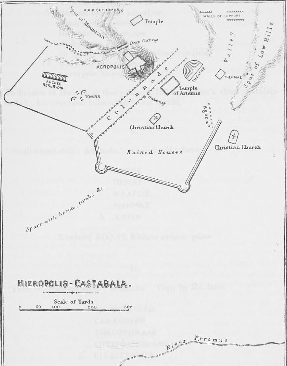
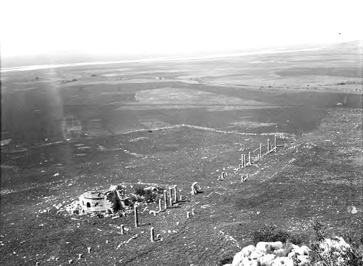
The most conspicuous feature of the place is the row of columns of red and blue conglomerate starting from the principal gateway, with Corinthian capitals and Ionic bases, similar, though less ornate, to those of the colonnade at Pompeiopolis at the coast near Mersina. There is an architectural feature about these colonnades – Pompeiopolis, Hierapolis and at Olba – which connects them with the colonnade at Palmyra leading to the Temple of the Sun, namely the bracket inserted in the drum of the column for carrying a statue and inscription which I do not know of elsewhere. note 13
The road space between these columns was 35 feet and the columns were erected at regular intervals of eight feet. This striking colonnade extended for a distance of 320 yards and apparently terminated at the back of the ancient theatre. Each row had about 78 columns as far as I could calculate, but it was difficult to arrive at the exact number as there are only 30 now left standing. The theatre is very large, the scena being 62 feet in length but it is much dilapidated. Besides these remains there are ruins of many public buildings. One apparently formed a stadium, another the agora, another the thermæ in the valley below, and not far from the colonnade are the ruins of a large temple: an aqueduct cut in the spur of rocks behind the town supplied the place with water from a source about six miles distant. Many fine tombs and heroa note 14 are dotted over the flat space sloping towards the Pyramus and there are the ruins of three Christian churches built out of the more ancient remains still left standing.
For a considerable time we were unable to come across anything to assist us in identifying the ancient name of this fine city but after devoting several days to a systematic turning over of likely stones we at last succeeded in collecting twelve inscriptions, note 15 from which we were able to restore not only the ancient name but also to establish many points of interest in connection with the place.
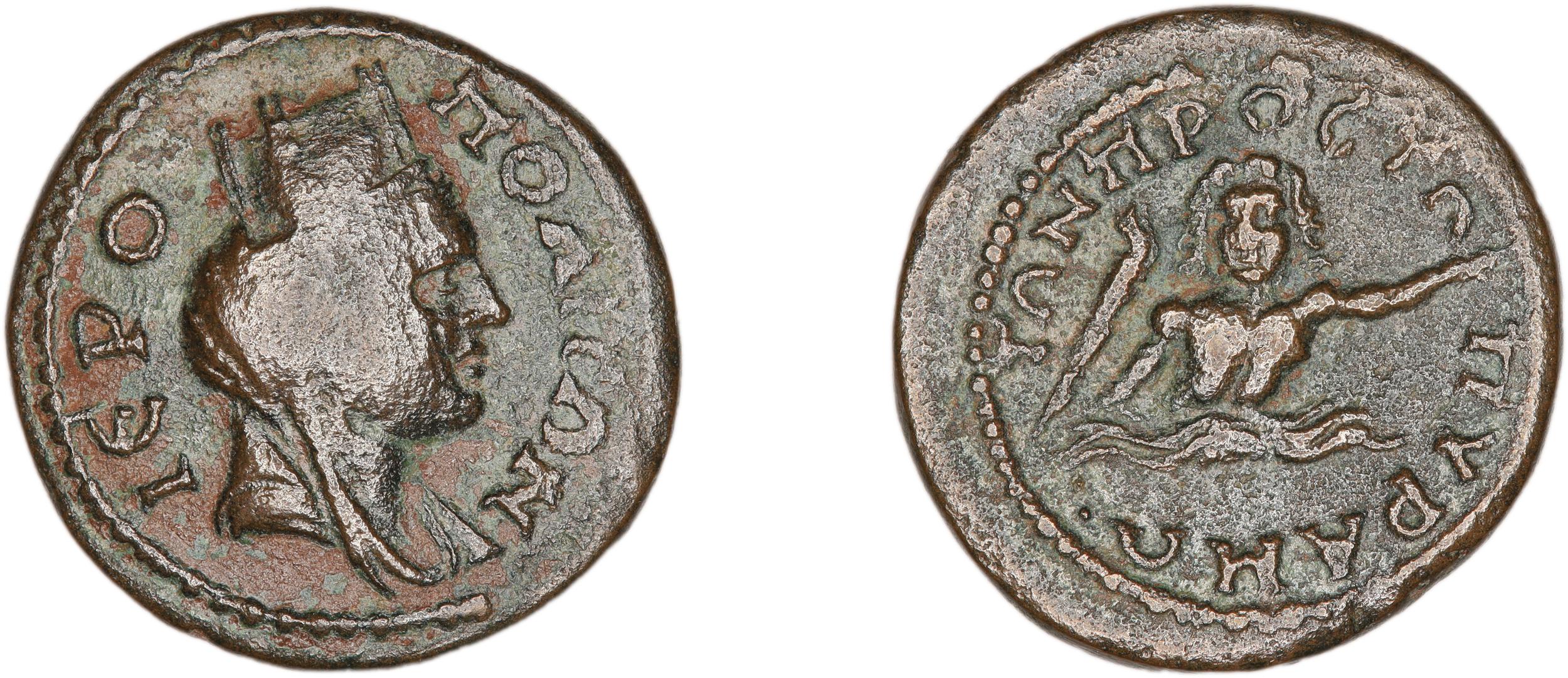
Four of these inscriptions were from dedicatory stelai and each began with the formula О ΔНМОΣ О ІEPOПОΛІТΩN, satisfactorily proving to us that this place was called Hieropolis in ancient times. On referring to numismatics we learn that this place was called by the double name of Hieropolis-Castabala, or “Hieropolis near the Pyramus”, with the river represented on them as a swimming figure with an aquatic bird swimming beside him and carrying a torch (πύρ). Other coins have the head of Artemis and the letters IEP (Imhoof-Blumer). note 16
This is what the geographer Strabo says about this place: “Two provinces only have cities. In Tyanitis is Tyana …. at a little distance from this city are Castabala and Cybistra, towns which approach still nearer to the mountain. At Castabala is a temple of Artemis Perasia where it is said the priestesses walk with naked feet unhurt upon burning coals. To this place some persons apply the story respecting Orestes and Artemis Tauropolos and say that the goddess was called Perasia because she was conveyed beyond the sea.” note 17
Two of our inscriptions conclusively prove that the Castabala which Strabo describes was here. One had on it the words ӨЕА ПЕРAΣIA, another found near the temple and the colonnade told us that an honorary statue had been put up “out of the revenue of the divine Perasia”. Furthermore, Ptolemy gives us further assistance in our identification by adding as a note to Hieropolis-Castabala “Perasia prius dicta”. note 18
Pliny’s statement that Castabala was a city of Cappadocia has led some geographers to think there were two Castabalas where Artemis Perasia was worshipped at some distance from this spot, but our evidence from epigraphy, substantiated by Strabo and Pliny, must conclusively place Hieropolis-Castabala here on the Pyramus and relegate the Cappadocia Castabala to the realms of uncertainty, and furthermore place Tyana and Cybistra in the locality also. Pliny’s geography is not nearly so reliable as that of Strabo and Ptolemy, and Cappadocia was under the Emperors a somewhat elastic term when the areas of the different eparchies were constantly being changed. Groskurd in his translation of Strabo has based an argument on an old Latin edition of Strabo that for Perasia should be read Persica, quite indeed at variance with the context; the argument in question was to maintain the Persian influence of the religion of Asia Minor but now our two inscriptions with the word Perasia upon them show that the current text is correct and rob the German scholar of one of the principal props to his argument. note 19 Several other points of interest are brought to light by our inscriptions, which I have not space to allude to here but I will name two. Out of the revenues of the temple of Artemis Perasia a complimentary stele note 20 was put up to a Roman legate Roscius Pompeius Falco governor of Cilicia, well known previously as a governor of Britain, of Lycia, Pamphylia Judæa and Asia Minor under Trajan and Hadrian, thus forming an interesting historical link between England and Cilicia in these early days. note 21 The second point of interest with regard to Hieropolis-Castabala refers to the itinerary of Alexander the Great. From Soli (Pompeiopolis) by the coast he marched to Pyramus, which he crossed at Mallus and reached Castabala on the second day and sent Parmenio forward to reconnoitre the pass (Curtius iii.7). note 22
Unfortunately, both the Antonine and Jerusalem itineraries are confused on this point, only speaking of a place Catabolo, and most travellers have sought to place Castabala on the coast between Ægæ and Issos. But without any epigraphical evidence this site was, of course, mere conjecture and I think the site of Hieropolis-Castabala may be conclusively taken to be the one Alexander visited for the following reasons. Firstly, it is not in the least likely that there would be two towns of the name Castabala within a space of 20 miles, and, secondly, Hieropolis-Castabala was a place of great strategical importance, being on the ancient main road from Anazarba to the defile behind Osmanieh, which is just across the Pyramus. It must, therefore, have been extremely important for Alexander to ascertain that no enemy from that direction was behind him and from here Parmenio could easily be sent to reconnoitre the pass through which the main road passed. From Castabala, Alexander, having made sure of the country behind him, could safely drop down to the plains at Issos from this point.
I think we may clearly say that the two problems – aliae Castabalæ [sic], the one in Cappadocia and the one by the coast, may be scratched out of the map and Hieropolis-Castabala on the Pyramus, the modern Bodroum, and certainly one of the most important towns of Eastern Cilicia in antiquity, inserted in their stead. Much of interest would doubtless be brought to light by careful exploration behind Osmanieh, a place which did not exist till 15 years ago, when the robbers who haunted the pass behind it were put down after making the borderland between Syria and Cilicia unapproachable. Years of war resulted in their being quelled and obliged to settle in Osmanieh. note 23
J. Theodore Bent, 13 Great Cumberland Place, W.
Footnotes
Return from Note 1
Return from Note 2
Return from Note 3
Return from Note 4
Return from Note 5
Return from Note 6
Return from Note 7
Return from Note 8
Return from Note 9
Return from Note 10
Return from Note 11
Return from Note 12
Return from Note 13
Return from Note 14
Return from Note 16
.
Return from Note 17
Return from Note 18
.
Return from Note 19
Return from Note 20
This sentence was one of Bent’s afterthoughts; he pinned it to page 1 of his MS on a small square of paper.
Return from Note 20
Return from Note 22
Some background to the Bents in Cilicia, Türkiye, in 1890
The RGS Manuscripts
Bent submitted manuscripts to the Royal Geographical Society, London, covering the two parts of the couple’s Cilician adventures in 1890. One ‘Explorations in Cilicia Tracheia’ was read out and published by the RGS in 1890, but the other, the topic of this present article, was not. The paper was instead read by Bent, on 8 September 1890, at the Leeds meeting of the Geographical Section of the British Association. This is referenced in the RGS Proceedings (Vol.12, 1890, p. 671), which notes that “This paper will be published in a subsequent number of the ‘Proceedings’”. This never happened – although Bent did use sections of it in some other articles that year (see the list of Bent’s writings on the region below) – one reason perhaps being that the explorer was imminently to become even busier than usual. A summons from Cecil Rhodes that Autumn made him drop everything and he and Mabel spent the last months of 1890 preparing for their campaign to Great Zimbabwe; the focus of their lives was to change radically… far from Asia Minor.
Cilicia, 1890
Having spent their 1887 season excavating on the then Turkish island of Thasos, the Bents hoped to soon return, but were thwarted by Istanbul museum director Hamdi Bey. Instead, for their 1888 explorations, they hired a fine schooner and drifted at ease from the Cyclades to Kastellorizo and back. One must add that by this time the celebrity explorers were regularly running into difficulties with the Turkish authorities (more on this later) and so for 1889 they took themselves off to Bahrain, which was under ‘British Protection’, i.e. they could dig at will, riding home part of the way, south-north, through Persia… as you do.
The cruise along the Turkish coast was so enjoyable, and promising archaeologically, that they returned for 1890. Essentially, what drove the Bents to southern Türkiye again was the challenge of certain ‘lost’ classical sites. On their way out in early 1890, in Athens, Mabel sees a “circular from the Hellenic Society requesting us to subscribe to an Expedition of exploration in Cilicia, to be headed by Mr. Ramsay [one of the regional specialists, Sir William Mitchell Ramsay] to start in June. ‘It is most desirable that the site of Olba should be discovered and identified.’ So I declared that we would look for Olba too.” (Mabel Bent 2006: 274). Typical Mabel this.
In early 1890 Ramsay was in the final stages (having it seems lost the initial draft – his ‘sketch’) of getting his great work The Historical Geography of Asia Minor (1890) to press, it being based on a series of arduous treks in the region in the mid 1880s. The work’s opening ‘General Principles’ section is still a commanding read. It seems Ramsay was holding off in part to see what the Bents might discover. He added a final note (p. 22) in his prologue after Bent had published (and some academic rivalry can perhaps be adduced): “… Mr. Bent discards Kastabala of Cappadocia entirely, and infers from Strabo that Tyana and Kybistra were in Cilicia near Kastabala. I adhere to all that I have written: my opinions were in print months before Mr. Bent travelled, and I consider them confirmed entirely by his brilliant discoveries.” Prof. Ramsay gives no source for his ‘opinions’ and neither, oddly, does Bent refer to them in his article. The site is indicated on Ramsay’s map (1890: 330) and speculated upon in his text (1890: 343-3). In May 1886, Ramsay read the first sketch of it before the RGS, and he tells us (1890: 3) “[it] was practically complete… when I read considerable extracts from it before the Aberdeen branch of the Royal Scottish Geographical Society [27 February 1888].” Neither of these presentations seem to have been published.
On 20 December 1890, Bent writes from his townhouse in Great Cumberland Place to Henry Walter Bates at the Royal Geographical Society: “Dear Mr Bates, [is] Ramsay’s book on Asia Minor out yet? I am most anxious to see an early copy for the completion of my Olba work… Our time is getting short now for other than Mashonaland work. Yours very truly, J. Theodore Bent.” (Royal Geographical Society Archive).
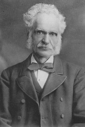
(H.W. Bates (1825-1892) was at that time in the last years of an extraordinary life and the abruptness of Bent’s letter jars somewhat – after all, this is the naturalist who spent 11 years in the Amazon region, seven as companion of Alfred Russell Wallace. Bates’ account, The Naturalist on the River Amazons (1863), is treasured. He spent his latter years as executive secretary at the Royal Geographical Society, responding to such letters as Bent’s. Wallace’s obituary of him (Nature 45(1165): 398-9), according to his Wikipedia entry, laments that “confinement and constant strain” of “mere drudgery of office work” for the Royal Geographical Society had with “little doubt… weakened his constitution and shortened a valuable life”.)
Olba was identified (discovery and identification being different achievements) in western – ‘Rough’ – Cilicia. The region inland from the south-western coast of Türkiye was divided in ancient times: to the west, Cilicia Trachea (‘rough’ or ‘rugged’), a mountainous region bounded by Mount Taurus; and to the east Cilicia Pedias (‘flat’), with its rivers and vast plains, not all fertile. Historically, the importance of Cilicia lay in its position either side of a great highway, accessing the East, which ran down from the Anatolian plateau to Tarsus and on through Syria into Asia and northwest along the coast to the Bosphorus and Europe. This highway passed through the dreadful gorge of the ‘Cilician Gate’ (and hence the region’s strategic importance when invaded by Darius, Alexander, et al.
The Bents and their considerable amount of gear, including Mabel’s cameras and image processing materials (see below), arrive at the port of Mersina/Mersin, their gateway to the region, on Monday, 3 February 1890 -“Very soon the porters bearing the 23 packages arrived. They were a wild looking lot of things, stove, table, chairs, beds, etc., and we had these to unpack and rearrange everything. I did not go out all day.” (Mabel Bent 2006: 276). Mabel Bent’s Chronicle, from which all her quotations here are taken (see references), helps us put approximate dates to the couple’s 1890 trek; it can be divided into three phases: (1) From Mersin, a first exploration of the Lamas region; (2) the journey via Sis to the site of Hieropolis-Castabala; and (3) a second attempt at the Lamas and the successful identification of Olba.
On the voyage out, the couple, arriving at Patras in the last week of January 1890, transferred to Athens, where they were joined by their regular dragoman, the Anafiot Manthaios Simos. Once ready, they then embarked from Pirea on Friday, 31 January for Smyrna, catching another boat soon afterwards which took them to Mersin, far south down the Turkish coast, arriving late Monday, 3 February. Having rested, they then rode northwards along the coast to access the Lamas Valley, and the Olba region. Following a furious and potentially dangerous contretemps with the governor of Silifka (21 February), the Bents, wisely, decide to postpone their work in the area and return to Mersin (26 February 1890).
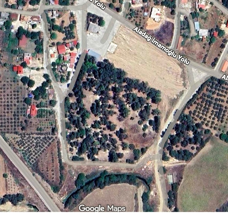
The celebrity explorers next head north-east, via Tarsus and Adana, to Sis (modern Kozan), reaching there on 6 March. They were obliged to spend a night on the road some 25 km south-west of Sis, as Mabel records (2006: 291-2): “We had to leave the road about a mile to reach a little village (Sarageshed)… We passed through a horrid cemetery… I was quite worn out and aching with fatigue. [The next day we] had to ride 6 hours to Sis… I flung myself on the ground with my head on my little camera and was very nearly asleep when Theodore’s voice, sounding very far off, invited me to eat a bit of cake with some wine, all we had, that we might not stop again.” The khan at modern Saygeçit (west of İmamoğlu) in which they camped no longer exists, but the ‘horrid cemetery’ clearly shows on Google Maps. (The occasions over almost 20 years of travel when we hear Mabel refer to exhaustion are not worth the bother of counting.) We can make allowances, therefore, when she adds: “Sis is one of those odious places which hide themselves behind mountains and round corners till the last minute…” (2006: 292).
A few days later (10 March), the party rides south some hours to the Afshar settlement at Anazarba (Anazarbus). (Nearly 20 years later Gertrude Bell is to visit the same site, but, disliking Mabel, she makes no mention in her diaries of the Bents; her photographs, however, are spectacular and several grace these pages. Mabel was never so successful with her photography, her ‘little’ camera has just been referred to. For this topic, see later.) The Bents were there three days investigating, living in a traditional reed hut, before (13 March) making their way east the short distance to ‘Kars Bazaar’ (modern Kadirli) for a two-day stay. Here, around the evocative remains of Ala Camii, Bent uncovers one of the mosaics that are now such a feature of the area, and is the first to make the suggestion that the site is ancient Flaviopolis, an identification now generally accepted. On 15 March they ride, via Hemita Kaleh (Hemite Kalesi) to their primary target, the extensive remains at ‘Bodroum/Boudroum’ (c. 2.5 km north of modern Kesmeburun), which Bent identifies as Hierapolis-Castabala. The couple spend four days here, leaving on Wednesday 19 March, reaching Mersin again, via Tarsus, on 22 March 1890. At Tarsus they make the acquaintance of eminent orientalist Dr Paul G.A. Schröder (1844-1915), en route from Beirut, and the only scholar they encounter on this trip (Mabel Bent 2006: 304).
Refreshed, the group begin a second attempt at identifying the extensive remains of Olba (Uzuncaburç), with monuments spaced over several kilometres, up the Lamas Valley, arriving in the heart of the complex on 28 March; their success there obliges even the gruff David Hogarth (1893: 654) to admit that the Bent’s Olba discoveries amounted to ‘a veritable Pompeii, many miles in extent’. (Bent’s highly unscientific approach to excavating in the region has provided another occasion for critics to deplore his methods.) In all, the Bents were nearly three weeks on this important part of their 1890 expedition, rough-camping among Yoruk tribes in this remote region, not returning to Mersin until 17 April. Fully recovered, in the company of local ex-pats, Mabel writes: “on Sunday afternoon [27 April] we said farewell to our kind entertainers” (Mabel Bent 2006: 319). Various steamers then returned the Bents to England by the second week of May 1890.
Unbeknownst to the explorers, the abovementioned issue with the governor of Selefka had developed so seriously that the HBM Consular staff at Adana wrote on 9 April asking them to curtail their activities (local officers had again been monitoring their activities and reported back) (Mabel Bent 2006: 308 ff). Mabel confides to her diary at the end of April: “But on our return to Mersina we found a letter, which it had not been possible to forward to us, which would have done away with all the good of our leaving England” (Mabel Bent 2006: 320). Had this letter reached the Bents in the wilds of Uzuncaburç they would have had to abandon their mission forthwith; they were extremely lucky not to have been seized by the Turkish authorities on the spot.
Private – Adana, April 9, 1890.
Dear Mr. Bent,
The Governor General, having received information that you are revisiting the same places you had already visited some time ago on the road to Selefka, and that you are taking photos or plans of the various places, requests me to make you acquainted with the fact that the taking of photos or plans of the places is not allowed without the special permission of the government.
His Excellency therefore requests me to invite you in a very polite manner to discontinue from taking photos, etc., as above mentioned. Complying with His Excellency’s request, I ask leave to add that it would be better if you came back to Mersina in order to avoid any possible troubles with subaltern officials.
The best way to continue your scientific investigations unmolested is, in my opinion, to request His Excellency, Sir William White, to obtain for you from the ministry at Constantinople the required permission. [signed] N.J. Christmann.

By way of a ‘PS’, one might add that Bent’s problems with the Sublime Porte date from 1883, when, after visiting Chios, Bent criticised the authorities for their treatment of the islanders following a series of disastrous earthquakes – they neither forgot nor forgave. Christmann might have been more relieved had he known that of all Mabel’s photographs of the Cilicia expedition, only two prints have surfaced, only a few processed images appeared in Bent’s articles (see references below).
References and further reading
Essential for the wider region is E.J. Davis, Life in Asiatic Turkey: A Journal of Travel in Cilicia, etc…. (London, 1879), an account of his travels in 1875, and surely kept in one of the Bents’ saddlebags as they traversed the same area. A travel writer of real skill, Davis’ account is still an evocative read. See also, e.g., Michael Gough, ‘Anazarbus’, Anatolian Studies, Vol. 2 (1952), pp. 85-150 and two publications by Richard Bayliss, ‘The Alacami in Kadirli: Transformations of a Sacred Monument’, Anatolian Studies, Vol. 47 (1997), pp. 57-87 and Provincial Cilicia and the Archaeology of Temple Conversion (British Archaeological Reports International Series 1281), Oxford, 2004. Also The Bents at Olba, Spring 1890.
Mabel Bent 2006. The Travel Chronicles of Mrs J. Theodore Bent, Vol. 1 (Greece and Türkiye). Oxford: Archaeopress.
Mabel Bent, My Seventh Chronicle: Rugged Cilicia 1890 (digital scan of Mabel Bent’s original 1890 notebook in the archive of the Hellenic Society, London).
Theodore Bent 1890. ‘Recent Discoveries in Eastern Cilicia’. The Journal of Hellenic Studies, Vol. 11, 231-54 (includes E.L. Hicks, ‘Inscriptions from Eastern Cilicia’).
David George Hogarth 1893. Modern and Ancient Roads in Eastern Asia Minor, co-authored with J.A.R. Munro (Vol. 3.5, Royal Geographical Society Supplementary Papers). London: John Murray. (Hogarth was another lion of the region with a distinguished career. His relationship with the Bents was mixed. He followed them over certain routes a little later in 1890, making several references and classifying (p. 654) their Olba discoveries ‘a veritable Pompeii, many miles in extent’.)
Victor Langlois 1863. Le trésor des chartes d’Arménie, ou, Cartulaire de la chancellerie royale des Roupéniens : comprenant tous les documents relatifs aux établissements fondés en Cilicie par les ordres de chevalerie institués pendant les Croisades et par les républiques marchandes de l’Italie, etc. Venice: Typographie Arménienne de Saint-Lazare.
W.M. Ramsay 1890. The Historical Geography of Asia Minor. London: John Murray.
Ali Nadir Zeyrek, Hierapolis-Castabala: The Urban Development in A.D. 1st to 3rd Centuries (unpublished PhD dissertation, University of Bologna, Italy. A relatively recent synthesis and analysis).
N.M. Yar and C. Küçük 2025. Kadirli Ala Mosque Mosaics and Museum, in R.A. Castanho, T. Pivac and A. Mandić (eds) Legacy and Innovation (CST 2023. Advances in Science, Technology & Innovation). Cham: Springer. https://doi.org/10.1007/978-3-031-59325-3_4
Related articles by Theodore Bent:
1883
1888
- ‘A Piratical F.S.A.’. [the Turkish coast] Cornhill Magazine, Vol. 58 (11), 620-35.
- ‘Discoveries in Asia Minor’. The Journal of Hellenic Studies, Vol. 9, 82-7.
- ‘Hamdi Bey’. Contemporary Review, Vol. 54 (July/Dec), 724-33. [Reprinted in Littell’s Living Age, Vol. 179 (1888), 613ff]
- ‘Three Ancient Cities on the Coast of Asia Minor’. Athenæum, Issue 3161 (May), 671 (Kasarea, Lydae, Lissa).
1889
- ‘Inscriptions from Theangela’. [near Etrim, Türkiye] The Classical Review, Vol. 3, No. 5 (May, 1889), 234-237 [E.L. Hicks, lead author].
- ‘Inscriptions from Casarea, Lydae, Patara, Myra’. The Journal of Hellenic Studies, Vol. 10, 46-85. [With E.L. Hicks]
1890
- ‘Cilician Symbols’. The Classical Review, Vol. 4 (7) (Jul), 321-2.
- ‘Explorations in Cilicia Tracheia’. Proceedings of the Royal Geographical Society and Monthly Record of Geography, Vol. 12 (8) (Aug), 445-63.
- ‘Notes from Cilicia’. Athenæum, Issue 3258 (Apr), 443.
- ‘Recent Discoveries in Eastern Cilicia’. The Journal of Hellenic Studies, Vol. 11, 231-54 (includes E.L. Hicks ‘Inscriptions from Eastern Cilicia’).
- ‘Tarsus Past and Present’. Blackwood’s Magazine, Vol. 148 (Nov), 616-25. [Reprinted in Littell’s Living Age, Vol. 187 (1890), 569ff]
- ‘The Site of Hieropolis-Castabala’. Athenæum, Issue 3273 (Jul), 104-6.
- ‘The Topography of Olba’. Athenæum, Issue 3267 (Jun), 742-4.
- ‘Notes on the Armenians in Asia Minor’. The Journal of the Manchester Geographical Society, Vol. 6, 220-22.
1891
- ‘A Journey in Cilicia Tracheia’. The Journal of Hellenic Studies, Vol. 12, 206-24.
- ‘Amongst the Cage-Dwellers’. Murray’s Magazine, Vol. 10 (57) (Sep), 348-61. [Reprinted in Littell’s Living Age, Vol. 191 (1891), 297ff] (S/E Türkiye, the Afshahs/Afshars of ‘Anazarba’, ‘Kars Bazaar’, ‘Boudroum’, etc.)
- ‘Inscriptions from Western Cilicia’. The Journal of Hellenic Studies, Vol. 12, 225-73 [by E.L. Hicks, based on Bent and others]
- ‘Archæological Nomads in Rugged Cilicia’. Blackwood’s Edinburgh Magazine, Vol. 149 (Mar), 377-91. [Reprinted in Littell’s Living Age, Vol. 189 (1891), 298ff]
- ‘A Secret Religion’. [Tarsus, Türkiye] Cornhill Magazine, Vol. 63 (16) (Jan), 65-74.
- ‘The Ansairee of Asia Minor’. The Journal of the Anthropological Institute of Great Britain and Ireland, Vol. 20, 225-6.
- ‘The Yourouks of Asia Minor’. The Journal of the Anthropological Institute of Great Britain and Ireland, Vol. 20, 269-76.
1892
- ‘The Two Capitals of Armenia: I – The Patriarch of Sis’. The Eastern and Western Review, Vol. 1(4), May, pp. 137-140 [in double-column, large format, with Arabic version also].
- ‘The Two Capitals of Armenia: II – The Patriarchate of Etchmiazin’. The Eastern and Western Review, Vol. 2(1), June: pp. 6-13 [in single-column, small format, no Arabic version].
1896
The Bents’ acquisitions from Cicilica (1890) in the Pitt Rivers Museum, Oxford
Bent read History at Wadham College Oxford in the early 1870s and was happy to donate (or sell) to the Pitt Rivers Museum (now only a few hundred metres up the road from Wadham) certain items the couple collected on their travels. Broadly speaking, traditional artefacts they collected in the 1880s were offered to the PRM, whereas the majority of all acquisitions from the 1890s went to the British Museum (e.g. the Great Zimbabwe material, 1891), apart from a couple of objects from the couple’s last trip (Socotra 1897) that found their way to the PRM after Bent’s death in May 1897.
From the Bents’ explorations within Cilicia (Türkiye) in 1890, the PRM has the following objects (not often on display), some can be given a possible provenance. (The items are not illustrated here, but may be seen via their site):
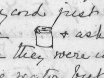
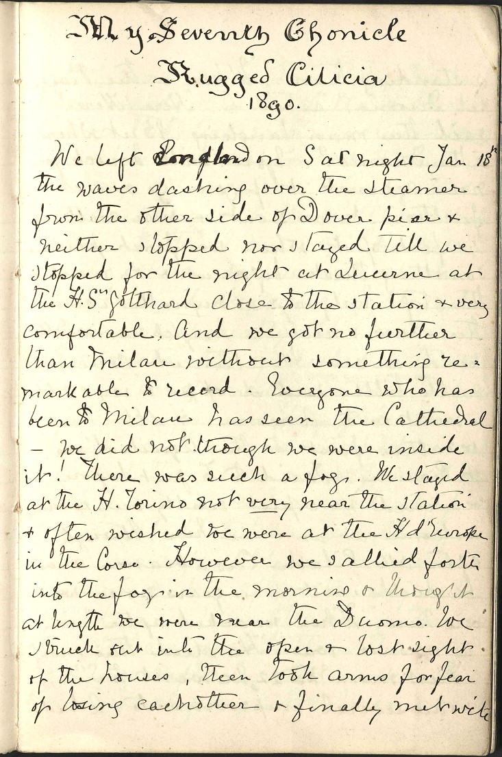
PRM1891.4.2.1: Wooden mortar/vessel decorated with concentric and incised swirls. A vertical carved flange runs down one side and is perforated. Shown on the same page is its large, leather stopper (PRM1891.4.2.2). (Such objects are mentioned by both the Bents in their writings; Mabel makes a doodle of one in her diary (illustrated above), perhaps the very pot now in the PRM, and thus from Sis.)
PRM1891.4.1.1. End flute and carved wood case (PRM1891.4.12), ornamented with woolen tassels and sling. (The Bents were fascinated by flutes of all kinds and returned from most of their trips with examples in all shapes and sizes.)
PRM1891.4.5: Coffee ladle or spoon. Coffee-roaster of iron with incised ornament and double folding handle. Copper alloy bands decorate the handle. (On the Silifka road Mabel Bent writes in her diary (10 April 1890): “While our tent was being prepared I was sitting in another where the mistress made the greatest haste to get coffee for me. She took a basket to the fire in which she had all the implements. There were a bag of coffee-beans, a folding pan in which she roasted them, a pretty wooden tray, with a spout in which she put them to cool, and a carved wooden mortar, very thick and with little space inside. It was closed with a leather lid with a great blob of leather inside to keep dust out…” (Mabel Bent 2006: 314-4). These may well be the items in the PRM today, i.e. with the ‘mortar’ and ‘lid’ (PRM1891.4.2.1 and 2 above) and ‘cooler’ (PRM1891.4.7 below).
PRM1891.4.7: Wooden coffee cooler, consisting of circular vessel, with handle on one side and protruding rectangular hole on the other. Decorated with incised patterning on inside and outside of vessel.
PRM1891.4.6: Youruk spindle of wood with curved cross pieces for a whorl.
PRM2007.6.1: Horn spoon or scoop.
PRM1891.4.4: Set of three finger caps or reaping gloves of wood. Davis (1879: 173) also notes these at Adana: “When engaged in cutting the grain the reaper wears a wooden defence, like a finger-stall, on several fingers of the left hand. When not in use, it is usually hung by a thong to his belt.”
PRM1891.4.3: Sickle with very long metal blade set into a cylindrical wooden handle. The blade has incised decoration on one face.
Mabel Bent’s photography in Cilicia 1890
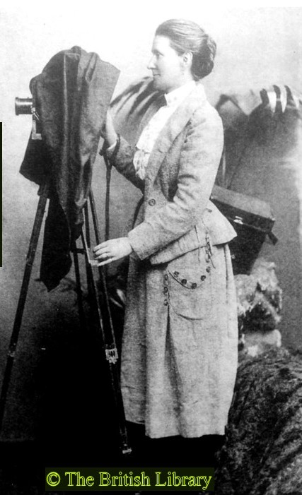
Some 15 years after the Bents visited Cilicia (spring 1890), Gertrude Bell followed in some of their footsteps (spring 1905); she had with her her camera, and the results are a unique resource. Mabel Bent had been delegated expedition photographer in 1885 (for the Dodecanese programme) but it has to be admitted that the task was a struggle for her – although, as with everything she did, she applied herself tirelessly (see elsewhere on this site).
For Cilicia 1890, despite all her efforts (with two cameras – a ‘small’ Luzo and a large stand apparatus), today we have only two (paper) prints and a few images in Theodore Bent’s articles that were adapted from his wife’s original material. (There was a set of 20 lantern slides held by the Royal Geographical Society but, very unfortunately, “[this] collection was destroyed on 9th February 1951 as it had faded.” Today, they could perhaps have been salvaged in some way.)
The best we can do, therefore, is compile a ‘virtual’ album from the many references to Anatolian photography Mabel Bent has left us in her 1890 Chronicle. You are asked to imagine late 19th-century Asia Minor in black and white (the dates are approximate; for the page numbers, see Mabel Bent 2006):
- Patras, 24 January 1890. Mabel’s photographic anxieties begin directly the Bents arrive at the Patras customshouse at the start of their onward journeys to distant Mersin, southern Türkiye: “At last I said, ‘I will not allow these things to be opened except in a place with red light, such as you no doubt have to open photographic things in, like in all large European stations’. ‘Red light!’ was exclaimed by all, and they all departed still saying, ‘Kokino phos!’ and presently returned and the officer begged our pardon humbly…” (p. 270)
- Mersin, 5 February 1890. The Bents are residing with the Dillon family, head of the regional railway: “I photographed the drawing room” (p. 276)
- Lamas Valley, 10 February 1890. The Bents are looking for the unidentified site of Olba: “High up we saw traces of an aqueduct cut. How they got up there we could not imagine and on a rock we saw a bas-relief which I tried to photograph with my little camera in the rain. Very luckily as it turned out it was too dull to take out the big one…” (p. 278)
- Lamas Valley, 10 February 1890. The Bents continue looking for the unidentified site of Olba: “When the acrobatic work of the epigraphist was over, that of the photographer began. Only a goat could photograph comfortably. Theodore leant hard against a tree, once he moved and it knocked me down… The legs of the camera were held on little cairns and I positively ached when it was over. Another photo I did kneeling with my legs over the edge of a rock about 4 feet high…” (p. 282)
- Lamas Valley, 18 February 1890. The Bents continue looking for the unidentified site of Olba: “We went more eastward this time, also down one valley and up another. I rode the little donkey nearly all the way. The place we went to was very pretty and filled with tombs, towers, temples of polygonal masonry. We found from a very tremendously large and puzzling inscription that the name of the place must have been Sabbatia. We were very busy with measurements, squeezes and photography and had a most pleasant day…” (p. 284)
- Lamas Valley, 19 February 1890. The Bents continue looking for the unidentified site of Olba. Mabel displays due diligence: “’How can I eat till I have taken my photographs?’ I responded. ‘The sun will be off by the time we have done.’ Of course, I cannot photograph unattended as I have to be held…” (p. 285)
- Lamas Valley, a Yoruk encampment, 19 February 1890. The Bents continue looking for the unidentified site of Olba. Never work with small children or animals: “When we passed in the morning I took the portrait of a tiny camel, 24 hours old. It looked so funny tied up in a coat; a handkerchief was put over his nose, crossed under his chin and tied round his neck. The first question, ‘Why?’ only received the answer, ‘It is the custom’. The second, to prevent the cold getting down its throat into its inside…” (p. 285)
- A café on the Silifke road, 21 February 1890. The Bents (in the wrong) have a close encounter with the local chief official (mutesarrif): “‘Very well,’ I said. ‘You will inform yourself better before you take English prisoners next time.’ So I whisked round my horse and turned my back on him and without goodbye we rode off, visibly laughing at him. I took his photograph…” (p. 288)
- Tarsus, 26 February 1890. The Bents are socializing along the coast from Mersin, to Tarsus, to Adana. In Tarsus, Mabel’s parea reveal an old stand camera and ask her to help resurrect it: “I superintended the unpacking of a beautiful camera which for 2 years has been suffering from the ravages of mice and damp; great ruin was the result. I put it together, explained the various parts, and today there is to be a little practice…” (p. 290)
- Mersin, 1 March 1890. Every photographer’s nightmare – unwanted daylight. Mabel’s assistant spoils all their plates from their first venture into the Lamas Valley: “Alas! I believe that all my photographs taken hitherto are spoilt. I gave them to be held in safety in the dark room by my pupil, but when I asked for them he had changed them to a safer place outside!” (p. 290)
- Sis, 9 March 1890. It appears the unidentified ‘pupil’ above was dismissed and Elias, another member of the team fresh from Adana, would assist: “I believe Elias has been brought and as he understands attending on the photography… I am glad.” (p. 295)
- Sis, 9 March 1890. Mabel repays her hosts’ hospitality by taking a group portrait: “The Family was very desirous of being photographed, so next morning I did a group of 11. Great were the preparations. Loose gowns were put off by the men and European trousers put on. Best gaudy clothes were put on by the ladies instead of their stockings, and more was thought of necklaces than of washing the legs.” (p. 295)
- Hieropolis-Castabala, 18 March 1890. The Bents have been on the move from Sis, exploring Anazarba and Kars Bazaar (Kadirli). Presumably Mabel took photographs but none are recorded in her diary. Later, camped at their goal, Bodroum (Hieropolis-Castabala), the photographer is again busy: “We only worked half today, finishing up with photography and measurements…” (p. 303)
- The Olba region, 30 March 1890. The Bents are again high up and westwards of the Lamas Valley. They succeed where others failed in identifying the site of Olba (Bent’s ‘Pompeii’ according to David Hogarth). Mabel is back working: “I took some photos and some measurements were done…” (p. 306)
- Silifke region, 16 April 1890. ‘Rough Cilicia’ lived up to its name in many places, frequently asking difficult questions of the photographer. Here Mabel is at the great sinkholes of Cennet and Cehennem near Silifke: “It is a truly awful place, quite terrifying in fact. It is quite inaccessible… It is surrounded by stalactites. I did not see the bottom. I was six feet from the edge… I feel as if I should like to have my camera tied before I try to photograph it.” (p. 318)
- Tarsus, 17 April 1890. The Bents are preparing to return to England and call in on their friends in Tarsus to say goodbye. It is an opportunity for a last (and lost) portrait: “I tried to start Mrs. Jennanyan with photography and we had very bad luck with the weather so cloudy and even rainy. Once I had got the whole of the Jennanyan family placed, 8 grownups and a baby, it rained. I was nearly wild! But it was hard to get them all together, so I ventured and did 2 and both were good, but that in one the babe and mother were blurs, but all our efforts were successful.” (p. 319)
 Leave a comment or contact us about this article