
 In 1912, Mabel Bent and her sister Frances Hobson felt there was a gap in the market for concise wall-maps of Palestine for schools and Sunday schools that would clearly show specific themes. Since 1900, Mabel was in the habit of visiting the region in the spring of most years. Her sister, Frances Hobson, was the wife of the Rector of Portadown, Northern Ireland, E.W. Hobson – who was soon to be appointed Chancellor of Armagh Cathedral.
Accordingly, the sisters had a series (possibly 5) of these maps produced by the well-known Edinburgh printers, W. and A.K. Johnson. They were priced at 1/- each (say £2.50 today), thus clearly the venture was not expected to generate a profit.
These maps are publicised in three contemporary newspaper articles: The Portadown News, 17 August 1912; The Belfast News-Letter, 15 August 1912; The Cheltenham Examiner, 26 December 1912. An extract from the latter reads:
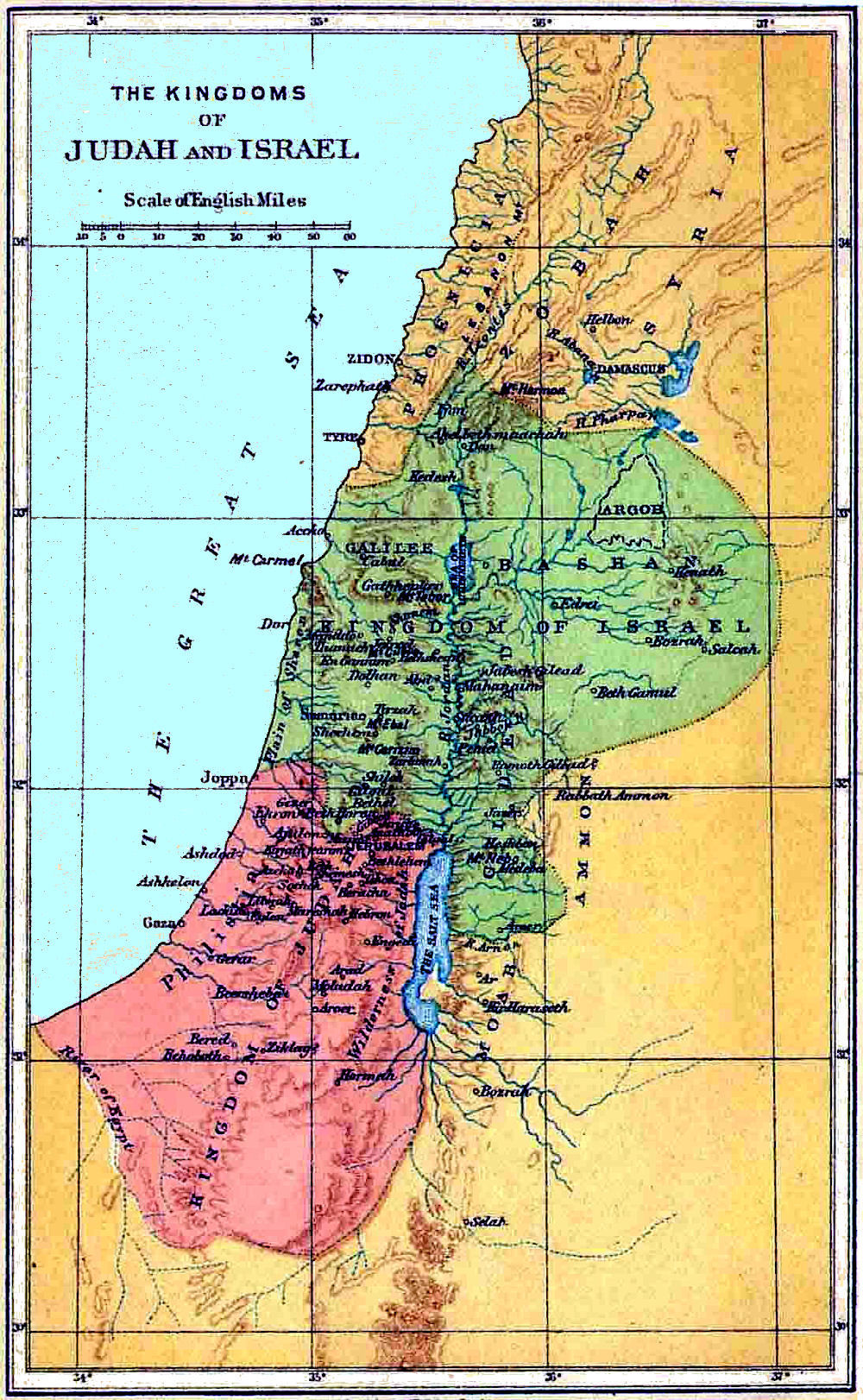
“These maps are the joint work of Mrs. Theodore Bent, the widow of the distinguished explorer and linguist, and her sister Mrs. Hobson, wife of the Chancellor of Armagh Cathedral, who is also the Rector of Portadown. Both these ladies are enthusiastic students of Biblical history, the former having had unique opportunities for the first-hand study of sites, boundaries, and general topography in Palestine and the surrounding lands. The Rector of Portadown has over a dozen Sunday Schools in his parish, and the practical experience gained therein brought home to his wife the difficulty of explaining Biblical history by aid of the ordinary school maps of the Holy Land, maps wherein, to use her sister’s picturesque description, ‘the boundaries of the Tribes and the Kingdoms are mingled with those of the Roman provinces, with the divisions of the Hivites and the Jehuites thrown in on the same map.’ The sisters accordingly put their heads together, and the result is an excellent series of five inexpensive and very simple maps, each giving the essential boundaries and other salient geographical facts connected with the Bible story at a particular period… The maps have been excellently printed by Messrs. W. and A.K. Johnson. Boundaries, rivers, mountain ranges, and just such names of places as are absolutely essential are presented in bold and striking outlines and letters, and in such a manner as to involve no strain on the eyesight of children in the rear of the class. They are printed in brown, white and black; but the use of coloured chalks for the purposes of special illustration is strongly recommended to the teacher.” [The Cheltenham Examiner, 26 December 1912]
The maps are rare and hard to locate (the one illustrated on this page is an example of the style of maps available in the early 20th century, it is not one of the Bent-Hobson series), however the British Library does list three of them:
- Lands of the Captivities of Judah and Israel, and of the wanderings of Abraham: Palestine and Mesopotamia. Natural scale, 1 : 2,217,600, etc. Edinburgh : W. & A.K. Johnston, [reprinted 1926]
- Kingdoms of Israel and Judah. Scale of English miles, 30 [ = 170 mm] Edinburgh & London : W. & A.K. Johnston, [reprinted 1932]
- The Exodus. Scale 1 : 760,320, etc. Edinburgh & London : W. & A.K. Johnston, [reprinted 1932]
If you have one of the original Bent-Hobson maps we would me most interested to hear from you.
 Leave a comment or contact us about this article