New interactive maps just posted on our site!
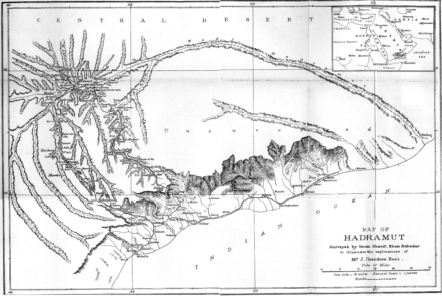
As Theodore and Mabel were wont to say, ‘A traveller without a map is like, er,….lost’. From Aksum to Zimbabwe, wherever they set out to explore, they always insisted on taking the latest maps with them; or commissioning special ones for their routes; or going so far as to take their own cartographers along with them (e.g. Imam Sharif’s map of the Bents’ expedition to the Wadi Hadramaut in 1894). Mabel later, in a short autobiographical article recalled: ‘In one of my investigations of the library at home I came upon a book that I made up my mind to examine. It had a delightful title “The Atlas of Undiscovered Countries”. It was firmly fixed, and to get at it I had to exert all my strength and become very hot, tugging out the great folios that were on each side, and then to my disgust I found my prize was only a false wooden book to support the upper shelf. Years after I exclaimed, ‘Now I have really an atlas of undiscovered countries of my own’, when I eagerly unpacked a map in eight sheets (that my husband had had made at Stanford’s, of Southern Arabia, when we were first thinking of exploring that part of the world) and found two or three of the sheets blank save for latitude and longitude marks. I am glad to say that the blank is not so large now…’
We are glad, too, to say that our website now has a series of interactive Google maps detailing the 20 years of the Bents’ expeditions. The most recent one added is labelled ‘The Bents’ Greatest Hits’ and shows the sites where the Bents made their most significant researches or discoveries in the 1880s and ’90s – from Aksum to Zimbabwe; the map also features a separate layer picking out significant locations for the Bents in England and Ireland. The pins are augmented with texts, photos, etc., and are very well worth a few minutes of your busy day – to transport you back to the late 19th century and days of solar topees, slow steamers, gin and quinine, leather portmanteaux, assorted adventures, and nights under unrecognisable stars…